Eating Our Way Around the World... One Continent at a Time

Every Friday afternoon two very special and well-loved visitors show up to the Wegener family homeschool. This year Kara is teaching her younger siblings art and geography, while Annie comes along to play with some of her aunts and uncles and Nonnie.
Annie

For most of us, Friday afternoons are the highlight of our school week. By that time, we are ready to turn our attention to some more creative aspects of our program. Kara, who minored in art at Purdue is not only an amazing fiber craftswoman, but she is a fabulous art teacher! (Check out the link on the side to Kara's portfolio blog that features some of her gorgeous hand knit and crafted items.) She's able to teach the younger ones to look at everyday items with new eyes and then translate some of what they see onto the paper in ways I never could. Maybe later I will describe a bit more what is happening with their art classes, but this post is supposed to be about geography.
One of our primary goals is that the children will create memory maps of the world (Faith on up) or the U.S. (Paul and maybe Ben) by the end of the year. So, though we are incorporating many resources, we're pulling many ideas from Mapping the World by Heart, a study which the oldest two now grown children, Andrew and Kara, completed more than ten years ago.
In addition to the run-of-the-mill physical and political mapping and memory assignments, country reports, and so on, we're also exploring spiritual and cultural aspects of many places. And what geography study would be complete without plenty of cuisine sampling? So far we've had a rather, um, unique regional U.S. dinner (imagine chicken pot pie waffles, fried green tomatoes and fried greens, a southwestern corn pudding, all topped off with Baked Alaska), a Jamaican dinner based on one of our scrawny roosters, and most recently, some very tasty South American appetizers.
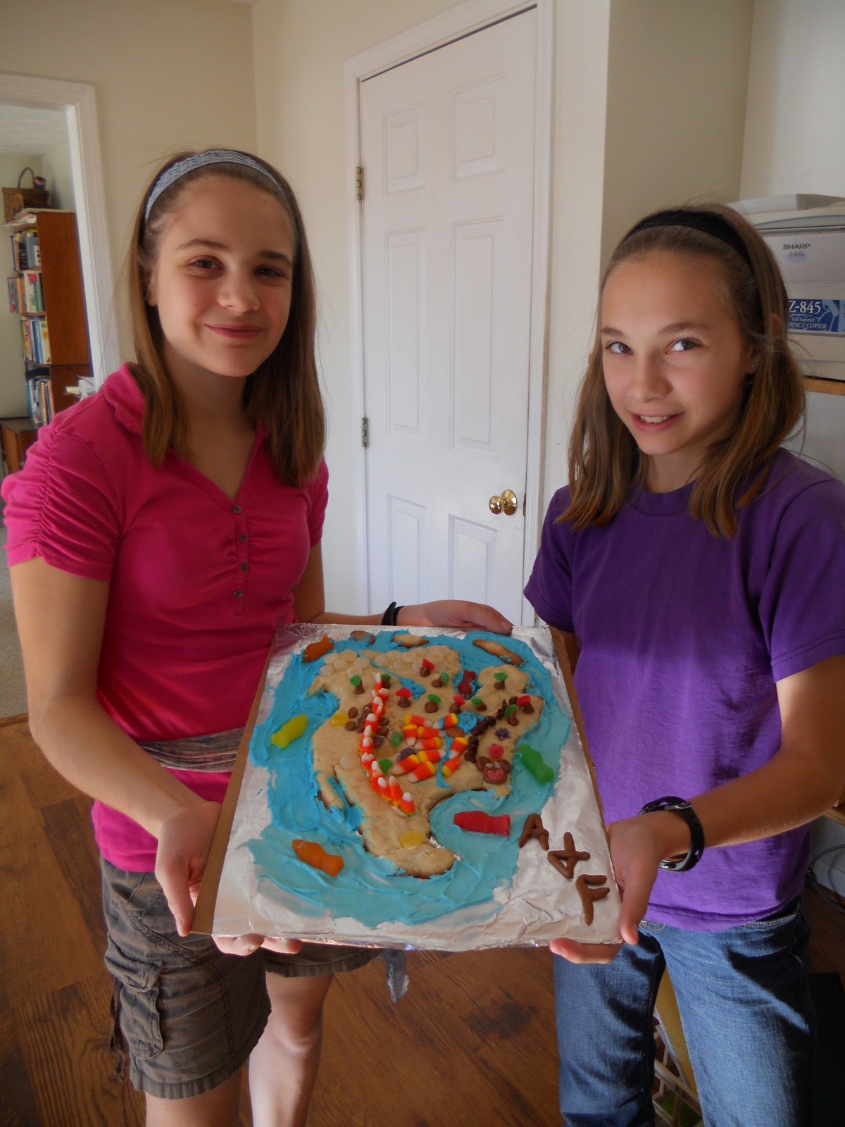
Our second way of eating our way around the world involves making edible continent maps. I have a plan for a different "medium" for each place that somewhat represents that locale. Here's what we did for North America:
First, the kids created North America base maps from cookie dough.

While the cookie maps were baking, the kids created various embellishments to represent geographical features. We had tootsie roll forests (Northwoods), tootsie roll potatoes (Idaho),

candy corn corn belts, and/or candy corn used as mountain ranges, or chocolate chips for mountains, and gum drops carved into all sorts of things from stars (capitals) to snakes and cacti for desert areas. Oh yes, there were also over-sized gummy fish swimming in the oceans. (Blue whales, maybe?)

After the maps cooled down, we added blue frosting rivers, the Great Lakes, and oceans. Here's Amanda and Faith's finished product:
Ben and Paul made individual, smaller maps. Here's Ben's:

Next up: South American tortilla maps.

Comments
Maybe we can have a final semester feast at Christmas?
We have a World Fair planned for early in January when I think you should still be here!